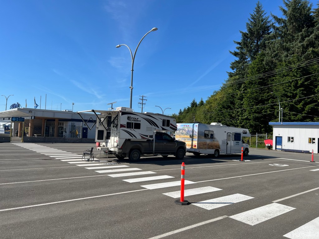
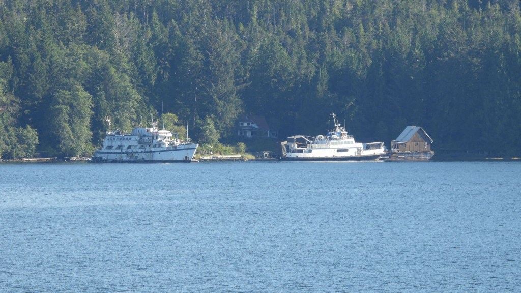
BC Ferries Parking Lot
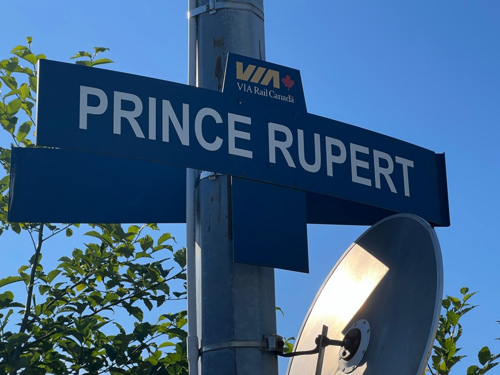
This lifestyle can have its drawbacks. I didn’t have many options when I arrived in Prince Rupert to catch the ferry, so the parking lot is where I stayed, I won’t say slept…
Let’s back up to daybreak
I can’t understate the good time I had in Hyder, Alaska. The people, the destinations, the bucket list items checked off the list, amazing. But I’m not sure if I was ‘had’ by someone or he did me a favor.
While at the RV park I stayed at in Hyder, I was hanging out the second afternoon having a cold one behind my truck when I saw this burst of water go skyward a ways across the park. Curious Jim had to check it out. Well, a below ground a water line had failed sending water higher than I thought seemed right, the reason I don’t tap into campground water supplies. I found one of the park owners sons and reported. I first saw one truck, then two, and finally a rally of ATV’s come to stand and watch the calamity. A short time later the park owner, a guy that looks very much like Otto Kilcher (if you don’t know do a web search) came over and thanked me for reporting and said unfortunately they would need to shut the water off on the line I was on. I said, no worries, not hooked up. He then went on to explain how there water is a point well tapping into the glacier water passing below the camp. The conversation went on talking about Hyder, his life story, the glacier, the bears…You know, like two old men do that have nothing better to do. He asked about my trip and then told me the route I needed to take down to Prince Rupert and what to look for of value. My plan was to stay on highway 37 right down to Highway 16 and over to see the Seven Sisters mountain. His reply, oh no, I know a better route that you have to take. His explanation on how to find the cut-off road should have been a warning, but Jim likes challenges.
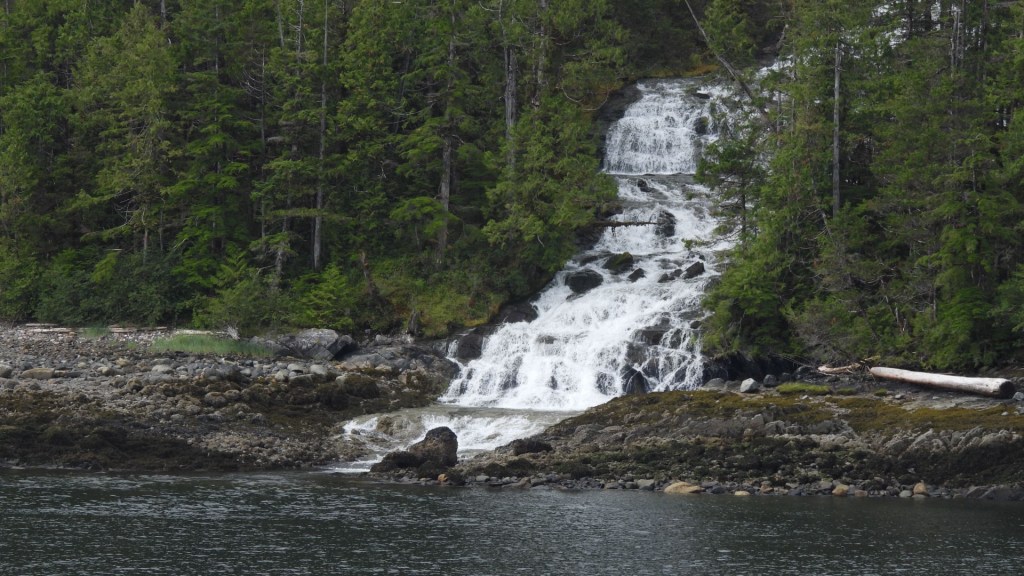
I was on the road early to catch the sunrise as I drove. Big score! Wildlife sightings and views were spectacular. I wrote in the last post of Highway 37a and the glaciers I saw on the south-side of the road going into Hyder. On the north-side of the road is a wall, a mountain that goes straight up pretty much the entire drive. Of course you can’t see that driving in. The locals call it the wall of tears or something of such. The entire drive there are waterfalls all along from a wall I’ll guess is a 1,000 feet high. With the sun at the right angle the drive was pretty much incredible. This takes me to the cut-off road that I couldn’t find cause the opening was so overgrown. I was told what to look for to be sure I was on the right roadway. A short ways in there will be a sign identifying it as a forest service road. Hmmm…He said, don’t worry, it’s not that bad…Hmmm…
Here Comes Trouble
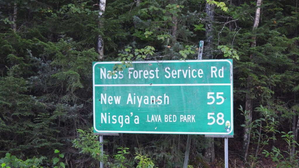
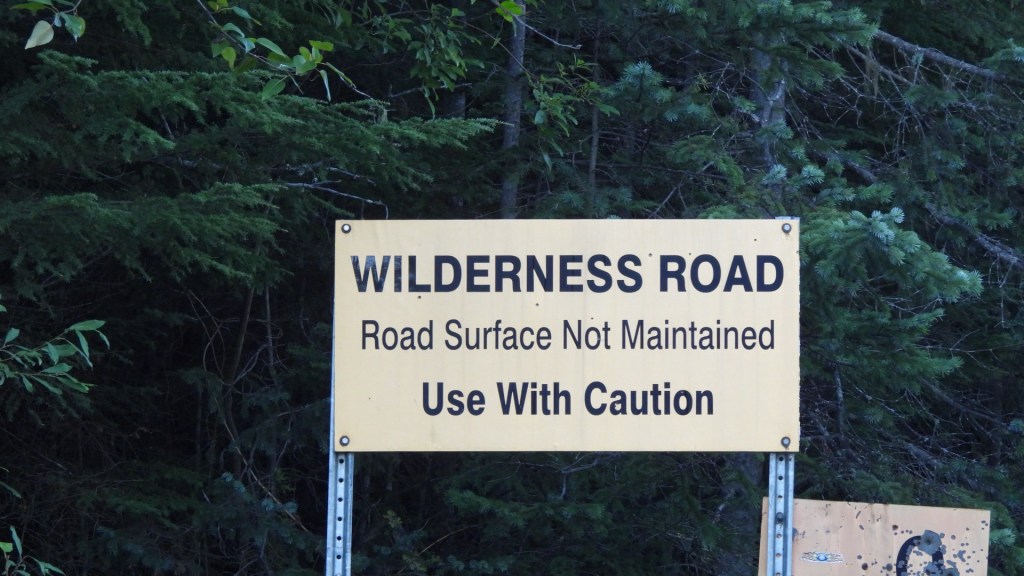
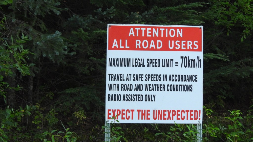
He didn’t tell me about the second two signs. I was a ways into the roadway when I saw these signs. I felt committed, or should I say, Jim doesn’t back down from a challenge.
On the bottom of the first sign is what intrigued me enough that I wanted to do this drive in the first place, the lava fields. How often does a guy from Wisconsin get to see lava fields?
Hold the steering wheel tight and go SLOW!!!
I’ve never found a good way to show road elevation change and deep holes with a camera. Camera views just can’t show how challenging, or should I say dangerous, road conditions can be. I’ll use this example to try to explain. This road is one lane wide for most of the route. When I came on a vehicle looking like it had shrunk a guy got out and looked hopeless. It was a native guy trying to get to a relative further up the Highway 37 I turned off of. There was no way to avoid what he got himself into and he had been there all night. The car had dropped into one of the seemingly bottomless pits and bottom the car out making it impossible to recover. It really was no problem, he knew what he needed, I gave him my shovel and he started digging so that we could attached the recovery strap I brought alone for just this occasion. Easy-peasy as they say. In 15 minutes we were on our way. Happy I wasn’t headed in the same direction cause I have a feeling that wasn’t the last time he would need help.
As for my truck, well, I survived the Dempster, the awful stretch of the Alaskan Highway near the US border of Alaska, not once but three times, but this road did me in. Sorta…I’ve got a foldable deck on the back of my camper making it easy to enter and exit the cabin. The deck is held up by a rather large pin with several guides to allow the locking/unlocking of the deck. The pin could bend I suppose but the guides, well, they just break. The guides are welded to the deck and bumper, the welds broke free on all the guide bracket weld points. That’s what they make ratchet-straps for, to bail you out when things break. Easy fix with the right tools, it’ll survive till I get home when I make it stronger than new.
And the lava fields?


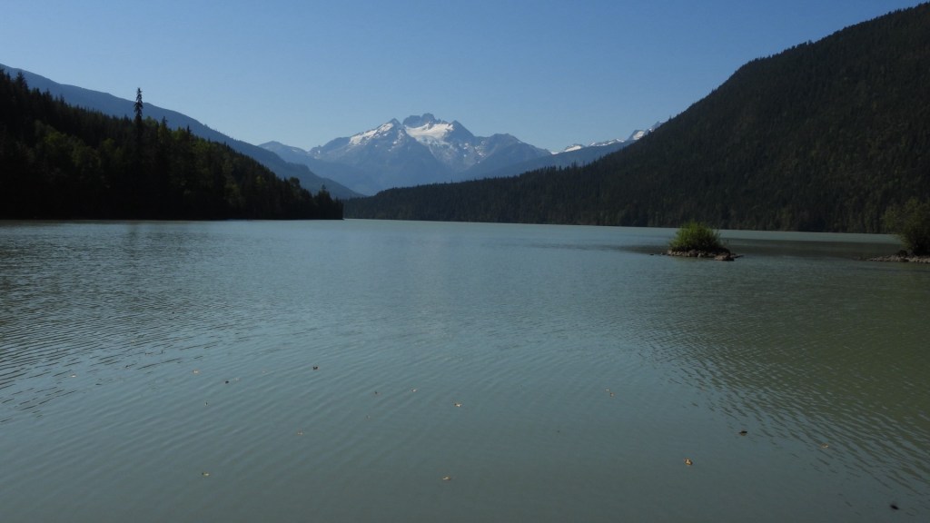
Well, I can say these lava fields were interesting to look at, but not sure it was worth the drive. They literally went on for miles until you come to a beautiful lake which they say is the crater. I’ll go with it but still not sure it was worth the drive.
What I did gain was a beautiful and recently repaved road that took me down to the needed Hwy 16 roadway and my path into Prince Rupert.
BC Ferries Express
I arrived at the terminal about 4:00 pm the night before travel. Your options are few as far as a place to stay. I suppose I could have tried hard to find a place to park for the night but arrival was 5:00 am the next day, and cut-off was at 6:15. If you weren’t in the yard, in line by 6:15 they had the right to refuse passage. I get it, they were busy getting all vehicles in the right place for loading so that the ship was balanced and all vehicles could drive in to their specific loading location quickly without utter chaos. But the night stay was interesting to say the least.
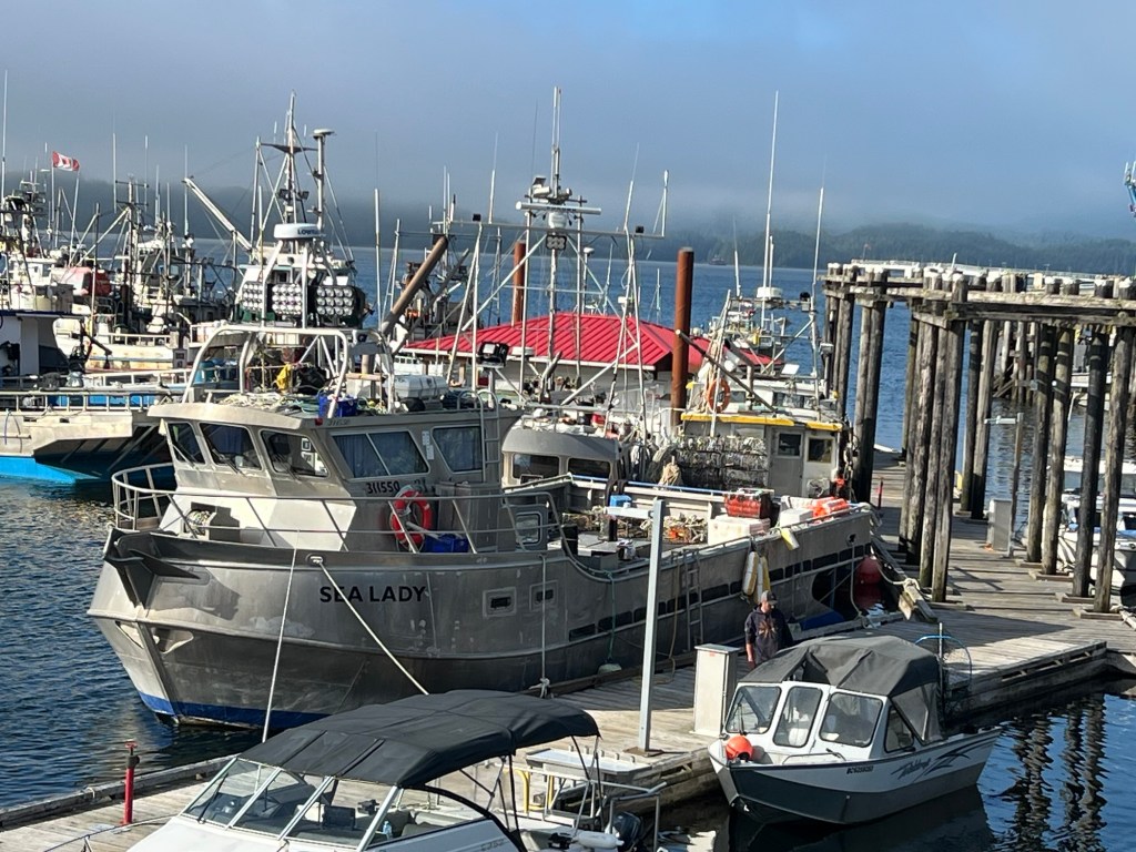
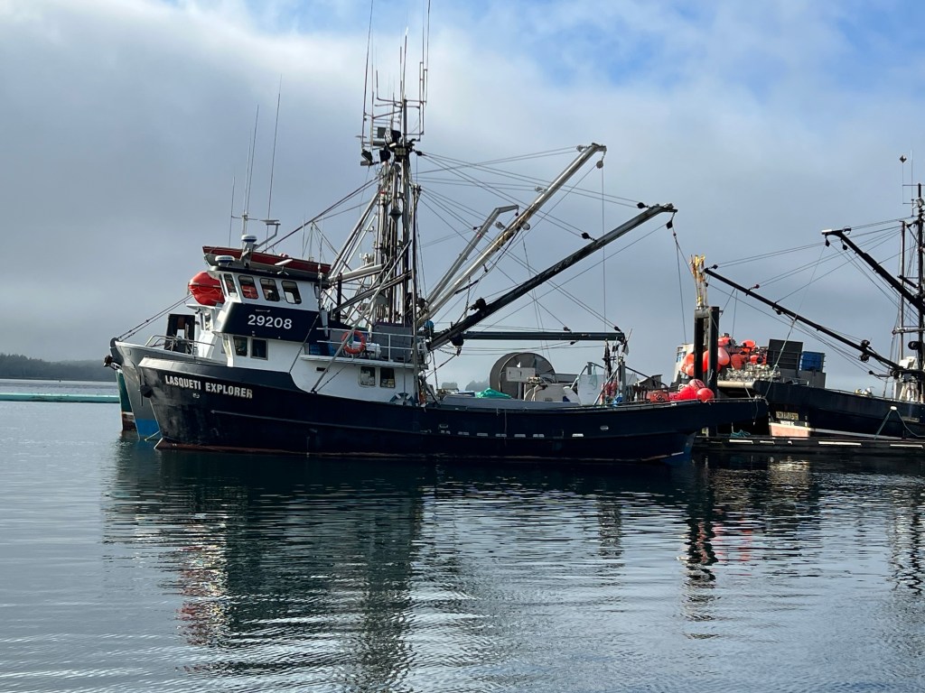
This is a major port. I’m not sure I could take enough pictures to show how busy this place is. There were two large ocean-going cargo ships being loaded. Think banging, horns, whistles, all night long. At 1:30am one ship pulled out of port. How do I know? Well, at 1:30 the ship started blowing its deep throated horn, while the tug boats with their high pitch horns played along. At 3:00am all the commercial fishing boats went out. How did I know? All the yelling and horns blowing made sure the city knew of their departure. At 4:00am a train pulled in loaded with cargo trailers to be sorted at the shipping yard. Think large loaders and overhead cranes. I managed about 3 hours sleep.
I have nothing but good things to say of BC Ferries, every person I saw employed by this company truly seemed happy to come to work. Not sure that could be said everywhere. The cruise was 16+ hours, and most ranking members worked those 16 hours, and to the end they were jovial souls, still had a smile and courtesy comments for all.
Sorry, no pictures of the ferry but it is big. With loading starting at 6:00am and arrival at our final destination at midnight, it was a bit dark for that.
Sail Me Away!

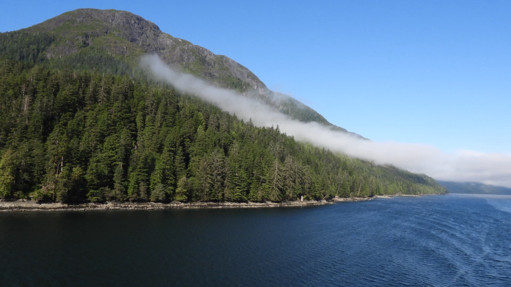
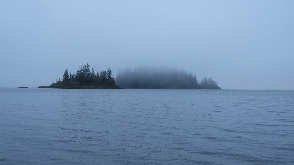
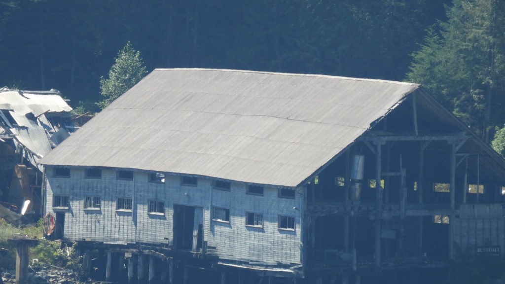
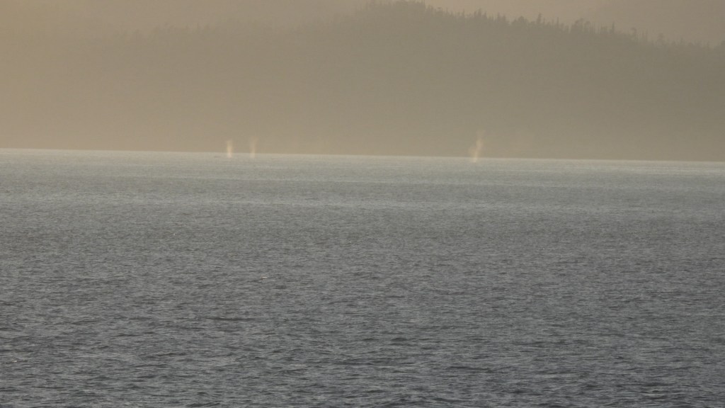
The ship follows what is called the inside passage. This route mostly keeps you off what could be the raging open Pacific but on this day we had nothing but calm waters. We had a few hours of fog, early, midday and evening, but most of the day was a spectacular day for sailing. The captain shared all the history found along the shoreline, from historic lighthouses to abandoned fishing villages. And the whale sightings? We have all seen the videos and images of whales seemingly jumping from the ocean, I’m here to tell you seeing that is like winning the lottery in this setting. But we did see a lot of whales. They would crest the water and blow water as they do, incredible in itself to see. At one point we saw a group of at 8 whales, all cresting and blowing at the same time. Tough to share an image but I’ve included one with three whales cresting together.
Where am I today
Vancouver Island- Port Alice
I’m spending two nights in Port Alice on the northwest corner of Vancouver Island. The drive here was pretty cool, like driving through a tunnel of trees where the road twists and turns continually. I’m right on the shore of a long inlet from the ocean, very peaceful and beautiful. I was up at 6:30 with my coffee at shoreline, saw one whale moving along in search of food. Pretty cool…
What’s next?
I’ll be heading to the central east side of the island near Courtenay for a 5-night stay on the shoreline. My goal there is to travel most days inland to the Strathcona Provincial Park where I should find tall trees in a rain forest type setting for some good hikes and hopefully wildlife viewing.
That’s all for now….
So, that’s all for this one. As always thanks for following and hope my trip inspires you to reach for your dreams. I believe by the end of next week I’ll be back in the lower-48, but that opens another chapter. Till next time…Peace!

Leave a reply to Sara R Cancel reply